Thursday, May 26, 2011

Closer to the Earth Gardening Project Part One: At the Farm


Bob sets us up for our interview with Rachel Kastner at Closer to the Earth
Production stills by Daniel Lay in this blogpost


We are back in New Mexico after 21 straight days of intensive, non-stop travel and filming but I still have so much to tell you about the people and places we visited in Oklahoma and then will also be 'grabbing' stills from Bob's footage for future blogs about our sometimes very challenging process in the making of this documentary and also my installation for the show at the Mabee- Gerrer Museum of Art as it enfolds. The documentary will premiere at the museum in Fall 2011 and a show of my installation and the work of other creative individuals we interviewed will be at the museum in Fall 2012. Our deep thanks to the Mabee-Gerrer Museum of Art for their sponsorship and also to the Museum of the Red River for lodging and feeding us while we were in Idabel. More on both of these museums and their collections in future blogs.
But now.....our final stop in our trip to hear about an innovative gardening program for youth and a community garden that has saved and brought together an urban neighborhood that was in decline in Oklahoma City brought together all of the ideas and concepts we are trying to promote in our Creative-Native Project series. It was a gratifying and inspirational end to our shooting schedule.

We met Rachel at the farm that is part of an innovative gardening program for at-risk youth. In our next blog we will take you to the community garden and native plant median plantings that are also part of this program and interview Allen Parleir, Coordinator of Closer to Earth Youth Gardens and you will hear about how their program restored an inner city neighborhood. This is a link to some of this year's projects. http://www.greeneducationfoundation.org/index.php?


Rachel in the garden at the farm
This program brings together ar risk youth from all different ethnic and socioeconomic backgrounds to learn about organic gardening and create organic gardens using methods such as composting and worm castings. It brings together youth who might never have the chance to interact with each other normally and also engages them in this program to give them an alternative to gang or criminal activity. 

The children take fresh produce home to their families many of whom have never had access to fresh produce especially organic. The rest of the produce is split between local food pantries and sold to local restaurants.

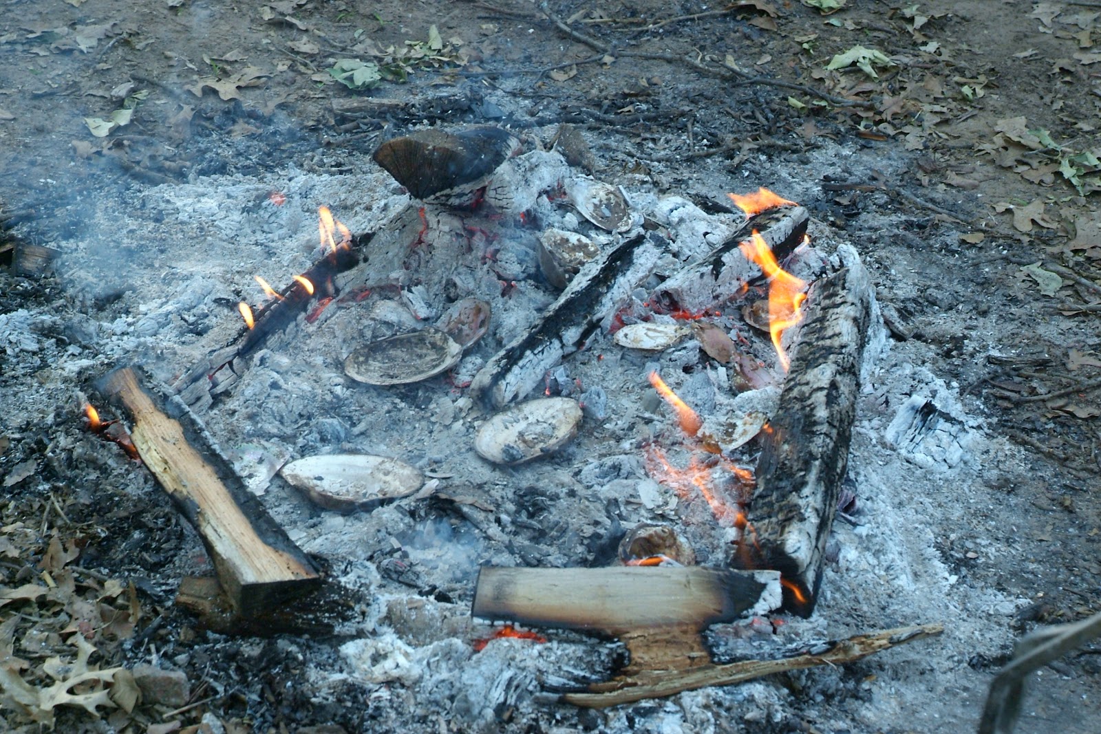
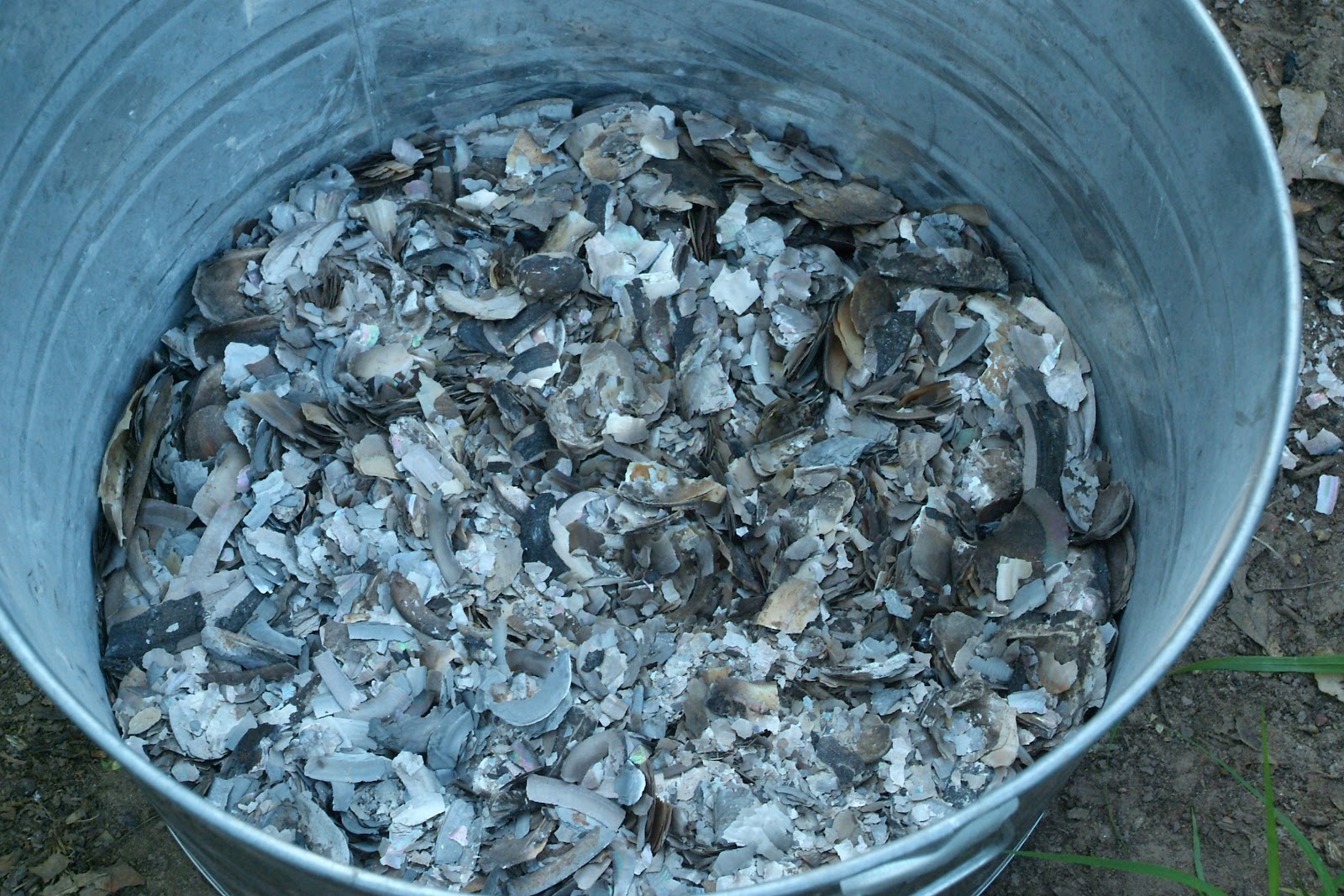
They do extensive composting and recycling as well as assisting in zero waste events and using all of their waste for their compost including cardboard.


All of the rich loamy earth in these two pictures is made up of worm castings which is literally the waste from worms which creates rich and healthy soil. You can see the worms in these two pictures if you look closely. Organic gardening emphasizes building the soil and crop rotation and diversity to create healthy plants without the use of pesticides.

The farm has a greenhouse which does not use a heating source, extensive composting, the worm compost and a quarter acre garden.


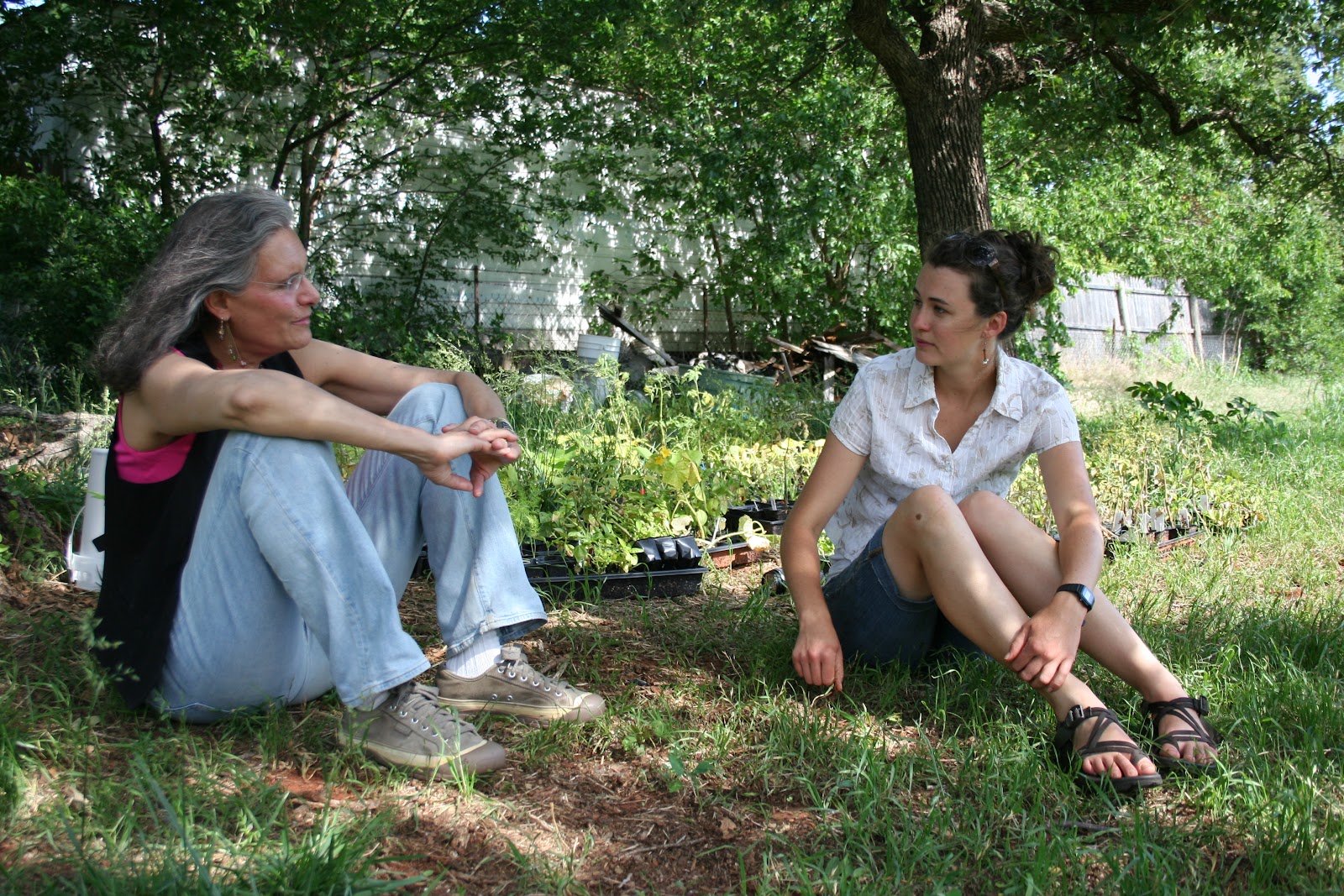
Rachel and I relax and talk after our interview and tour of the farm. Tomorrow we take you to the Community Gardens and the six block highway median that the youth have planted in Oklahoma native plants and also see the youth at work and hear about how this program revived a community.
This link will take you to an update on Closer to the Earth and the $5000 grant they received from the Green Foundation and how they have put it to great use.


Wednesday, May 25, 2011

Photographer Kim Baker shows us three more wild and beautiful spots in Oklahoma


Red Rock Canyon by Kim Baker copyright

It is hard to capture the true lusciousness of what we see in nature with our eyes through a camera as so many other things like sound and smell filter our experience, but somehow Kim Baker captures that visceral experience of being there. As a Conservation Photographer she also brings awareness to the wild places in Oklahoma that need to be preserved. Many people outside of Oklahoma do not realize how varied and beautiful the state is.
The links above will take you to basic info about Red Rock Canyon State Park in central Oklahoma near Hinton.


Wichita Mountains by Kim Baker copyright

We went to this fascinating area with Katherine Liontas-Warren and her friend and fellow artist Jack Bryan. Look at previous blogs for a description of our trip and Katherine's stunning drawings and prints in black and white, of the Wichita Mountains. I highly recommend a trip to this refuge. There are so many stunning areas in the park that we did not get a chance to see but will go back to on another trip.
The Wichita Mountains are located in the southwestern portion of the U.S. state of Oklahoma. The granite mountains, about 500 million years old, are rounded by weathering. The Wichita Mountains Wildlife Refuge, a favorite for hikers and rock climbers in the region, is located adjacent to Cache, Medicine Park, Indiahoma, and historic Meers while just a short drive from Lawton. Buffalo, elk and deer are protected on the 59,020-acre (23,880 ha) wildlife refuge. The Field Artillery capital of the world, Fort Sill, occupies the southern part of the range. Backcountry camping is available in the Charon Gardens Wilderness area. It is also home to Treasure Lake Job Corps. Additional points of interest are the Wildlife Refuge visitors center, Holy City of the Wichitas, Quanah Parker Lake & Dam, Lake Lawtonka, and Quartz Mountain Nature Park.
Geology
The geologic history of the Wichita Mountain region began with the deposition of late Precambrian to early Cambrian sandstones. These sandstones were intruded by coarse gabbro sills of about 575 million years ago[1] as the region began to rift apart in a failed continental breakup. The gabbro intrusion was followed by erosion and further intrusion of granite accompanied by volcanic eruptions of rhyolite lava and explosive volcanic breccias some 50 million years later.[1] Following these igneous episodes the region subsided and shallow sea sediments were deposited over the area consisting of sandstones and limestones.
During the Pennsylvanian Period (330–290 million years ago) the region was subjected to intense pressure during the continental collision or orogeny which produced the Ouachita Mountains to the east.[2] This resulted in faulting and folding and the formation of the Southern Oklahoma Rift. This rift strikes in a WNW direction and includes the Arbuckle and Wichita Mountains of southern Oklahoma and the Amarillo Uplift of the Texas Panhandle.[2] Up to 20,000 feet (6,100 m) of local uplift occurred during this time.[3] This uplift created rugged mountains which have been reduced to their present state by erosion. At 2,464 ft (751 m) Mt. Scott is the second tallest mountain within the Refuge boundary. Mt. Pinchot in the Special Use Area is 12 feet (4 m) taller. A paved road leads to the summit of Mt. Scott, from which visitors can see for dozens of miles on a clear day. The highest peak in the Wichita Mountains (including areas outside the refuge) is Haley Peak, at 2,481 ft (756 m). Haley Peak (officially unnamed) is located on private property just outside the NW corner of the refuge. [Haley Peak Elevation information from records stored at USGS/NSDI Standards Team/NGTOC III/Mid-Continent Mapping Center/Rolla, MO.]
When the area was part of Indian reservations and therefore off-limits to non-Native Americans, the Wichita mountains were rumored to contain rich gold deposits. When the area was first opened up for settlement, many prospectors staked mining claims, and towns were laid out to serve the presumed bonanzas, but no economic deposits were found. The gold boom was prolonged by some unscrupulous assayers who found gold in every sample, but the miners eventually gave up, leaving behind ghost towns such as Wildman, Oklahoma.[4]


Tallgrass Prairie by Kim Baker copyright

This was one of my favorite  places that we visited and you can go back to earlier blogs to read about our time there. It has a very subtle beauty that is particularly hard to capture but once again Kim does it masterfully. We plan to go back in the fall when the grasses are seven feet tall as we will be in Shawnee for the premiere of our documentaries on Oklahoma from the Creative Native Project which focuses on art, sustainability, creativity, mentoring and cultural preservation and how they support each other.
We thank the Nature Conservancy for protecting and enhancing sustainability in this special place, one of many they are protecting nationwide and in Oklahoma. We interviewed Bob Hamilton, director of the Tallgrass Prairie Preserve and Chris Hise, director of the Four Canyons Preserve both of whom emphasized how they preserve and restore the ecosystems of the preserves and also reach out to the neighbors to help them learn how to take part in the sustainability on their properties and educate them about how that can be achieved. Showing how that can be achieved on the preserves is much more potent for reaching out than lecturing or telling.

The Tallgrass Prairie Preserve, located in Osage County, Oklahoma near Foraker, Oklahoma, is owned and managed by The Nature Conservancy. It is protected as the largest tract of remaining tallgrass prairie in the world. The preserve contains 39,000 acres (160 km2) owned by the Conservancy and another 6,000 acres (24 km2) leased in what was the original tallgrass region of the Great Plains that stretched from Texas to Manitoba
Description
The preserve is located at the southern end of the Flint Hills, a rocky, rolling prairie that stretches from northern Kansas into Oklahoma. Exposed limestone formations and those close to the surface have made cultivation difficult and thus the Flint Hills have survived much as they were when they were an Indian hunting ground for tribes such as the Wichita, Osage, and Kaw. The region is called “The Osage” by Oklahomans, referring to the name of the county and the Indian tribe to which the land belonged. Pilots call The Osage the “Black Hole” when flying over it at night because it is so lightly populated.[2]
Prior to its purchase by the Nature Conservancy in 1989, the preserve was called the Barnard Ranch which had been part of the Chapman-Barnard ranch of 100,000 acres (400 km2).[3] The foreman of the Chapman-Barnard ranch, Ben Johnson, Sr. was a rodeo champion. His son, also a rodeo champion, was Ben Johnson, Jr. who appeared in more than 300 movies and won an Oscar for his role in “The Last Picture Show.”[4]
The preserve is bisected by well-timbered Salt Creek and its tributaries. The eastern portion of the preserve is in the Cross Timbers, a north-south running belt of tangled oak forests that were a major impediment to early travelers heading west.[5] About 10 percent of the preserve is forested and the remainder is tallgrass prairie with grasses of several species that can grow ten feet tall.[6]
The tallgrass prairie owes its existence to fire, whether caused by lightening or manmade. Without fire, the prairie quickly becomes brushland. The Indians were aware of this and burned the prairie regularly to nurture new growth of succulent grasses and to kill intrusive trees and shrubs. The Nature Conservancy has continued this practice with a process called “patch burning” in which about one-third of the prairie is burned each year. This process has proven beneficial not only for bison and cattle, but also for the threatened Greater Prairie Chickens which also inhabit the preserve in small numbers.
Bison are the most prominent attraction of the preserve. The herd numbers more than 2,500 and grazes 21,000 acres (85 km2) of mostly open range. Bison are rounded up each fall and the excess numbers sold. Cattle are grazed on 11,000 acres (45 km2). The preserve supports 755 plant species, many unique to the tallgrass prairie, and more than 300 bird species.[7] Forest trees include several species of oak, cottonwoods, ash, red cedar, elm, sycamore, and others.
The Tallgrass Prairie Preserve is on the Osage Indian Reservation. The Osage Indians retained sub-surface mineral rights on all their former lands and the petroleum on their reservation made them the richest people per capita in the world in the 1930s. There are still more than 100 producing oil wells on the preserve. Bison graze unhindered among the oil wells.[8]


Tuesday, May 24, 2011

Kim Baker shows us the Majesty of Oklahoma


Black Mesa by Kim Baker copyright
Black Mesa is a Nature Conservancy Preserve in the arid panhandle of Oklahoma.
Located in Cimarron County, Oklahoma, Black Mesa Nature Preserve consists of approximately 1,600 acres. In 1991, the Conservancy conveyed its property to the Oklahoma Tourism and Recreation Department with restrictions regarding development and other use. The preserve protects about 60% of the mesa top in Oklahoma in addition to talus slopes and plains habitat. A native granite monument marks the highest point in Oklahoma — 4,973 feet above sea level.
The Black Mesa area supports 31 state rare species (23 plants and eight animals) and four community types. Here, the Rocky Mountains meet the shortgrass prairie and it is unique in that it represents an area where many species are at the easternmost or westernmost portions of their range. Vegetation on the top of the nearly flat mesa comprises a Bluestem-grama shortgrass community. The mesa's talus slopes support a one-seed juniper/shrub oak community, while similar slopes of neighboring smaller buttes support a one-seed juniper/pinyon woodland community. The plains below the mesa support a shortgrass prairie.
Black Mesa is a birder's paradise any time of the year. Golden eagles, scaled quail, black-billed magpies and pinyon jays are just a few of the birds that may be observed. Black bear, bobcat, mountain lion, mule deer, bighorn sheep and antelope are some of the mammals that may be seen in the mesa region.


Conservation Photographer Kim Baker shows us the wild and beautiful spots in Oklahoma not only to capture them for posterity but also in the hopes of promoting their preservation. Most people outside of Oklahoma are not aware of the diversity of microclimates and spectacular landscape and many types of trees that live in these many unique spots. 
We attended "The Illinois River Survey" on the opposite side of the state from the Black Mesa. It was a three day event that Kim put enormous energy into planning in order to bring attention to the need to preserve this Oklahoma wild and scenic river. Here are some production stills at the event on the banks of the river at various spots. The river had just undergone a 500 year flood so the waters were much higher than usual and the banks much changed. While there was a great deal of flooding damage in Tahlequah for which we are greatly empathetic for those affected, on the positive side as Ed Fite, Administrator of the Oklahoma Scenic Rivers Commission pointed out this kind of event actually helps to clear some of the pollution and bacteria out of the river. 


Kim Baker and her equipment


Filmmaker Bob Demboski and Kim walking to a beautiful spot on the Illinois River much changed by the flood.


A gravel bar that wasn't there before the flood.....


Kim getting ready to shoot a very changed spot on the river where she has shot before.


Ripples in the gravel bar from the fierce action of the flood waters.


Beautiful spots along the river...


Some with rock ledges....


Examining the life and health of the river at the Illinois River Survey
See a past blog for a full itinerary of what took place in the three day event.


Seining to find life in the river....


Lower Mountain Fork River by Kim Baker copyright


Lower Mountain Fork River in southeastern Oklahoma is located just northeast of Broken Bow.  The Lower Mountain Fork River, the tail water of Broken Bow Lake, offers year round rainbow and brown trout fishing.  This is a great fly fishing spot.  Beavers Bend Resort Park has water front camp sites on the Lower Mountain Fork, and some nice swimming holes.

Kim has told me there are some wonderful trees on the Lower Mountain Fork River. We must go back to south eastern Oklahoma and investigate. They also mention swimming holes on the website above and swimming is a passion of mine.

The next blog will show three more wild spots from Oklahoma in Kim's portfolio of spectacular photographs. The Oklahoma Scenic Rivers Commission has worked with Kim frequently and has great respect for her work and mission. They used one of her photographs of the Illinois River for their poster.  


Saturday, May 21, 2011

Beauty and Diversity in McCurtain County, southeastern Oklahoma

We interviewed Quintus Herron, a pioneer of sustainable forestry in Idabel as well as the founder of the Museum of the Red River with his wife Mary. We will show more production stills and talk about Quintus's tree farms in a future blog.
Quintus showed us around the beautiful property where he lives with wildflower meadows and and an arboretum of diverse trees. Here are a few pictures with more to come later. This blog is about some of the beauty I saw that inspired me for future work in my studio. I shoot with a still camera not as an end in itself but as a reference and starting point for my drawings/paintings.


Lacy cypress fronds


Quintus's cypress swamp on his beautiful preserve property


I took lots of shots of this river birch on Quintis's land for a future tree painting. I love the peeling, curling bark.


There are palmetto mounds in McCurtain County.


There are lots of boggy spots and I made the mistake of going into the woods off the road to see more palmetto and was instantly attacked by the largest mass of mosquitos I have ever experienced. I high-tailed it out of there!

Here are some closeups of patterns and textures of pots and textiles from the Museum of the Red River that I found inspiring. In a later blog you will get more of a sense of this wonderful museum from wide shots and also from the large collection in storage as well as on display. As you will see I love pattern and design.


The intricate design is stunning.


As well as the beautiful form......


Creek Seminole Shoulder Bag
I used some of these patterns for a series of paintings I did including tropical plants and mixed media.
See "Epiphytes", "Flower of the Fruit" and "Birds of Paradise" at the above link.


Choctaw Shoulder Bag


An African Pot with wonderful texture. I believe Henry Moy said this was a water pot?????
Ouchhhhhh.....


These are two closeups are from long scrolls made of Waxed Cloth from Quizhow, China. I love all the detail and pattern work.


Friday, May 20, 2011

Firing the Choctaw Pots


Heating the mussel shells used in the clay mix for temper until they are just ready to crumble at which point they are put in a bucket for use in the clay mix of future pots.


Pulling the mussel shells out of the fire and crushing them in the pot.


They are building up hot coals in the fire pit and putting the pots around it to drive out any excess moisture and warm them so they are not shocked by the heat in the pit when they are put in there.


There are two fire pits for this firing because of the number of pots. Dr. Ian Thompson lays down pottery shards to put the pots on top of to act as an insulator between the pots to be fired and the hot coals. It is important to build the heat slowly so as not to shock the pots and fire them slowly.


The pots are laid on top of the pot shards that cover the hot coals. A ring of wood encircles the outer edge of the pit with cedar chips to accelerate the burning. The ring slowly moves in closer to the pots until they are hot enough to be covered by the fire to hopefully avoid breakage by slowly increasing the temperature of the pots.


We had to head from Durant to Idabel before the end of the firing which will go on for about 3 more hours so we will be getting jpgs of the rest of the firing from Dr. Ian Thompson and the excitement of taking the pots out of the pit the next morning when they have cooled sufficiently. Bob has video footage of the pots just beginning to glow red so tune in for the follow-up blog.


Water Bottle and Duck Bowl by Laura Soloman

We will show you beautiful pots from Dr. Ian Thompson and his students at the Choctaw Nation in Durant, Oklahoma in later posts as well as pieces that have either been in exhibition or added to the permanent collection at the Museum of the Red River in Idabel, OK as well as showing you a lot more about the museum and our interview with Director Henry Moy and founders Quintus and Mary Herron.


Choctaw pottery survived into the 20th century with only a few practitioners. Grady John, who learned the craft from his cousin L.D. John, created duck, crawfish, and opossum effigy pots as well as bowls and jars using all the traditional ways. Both, Mr. John and his uncle worked at the Chucalissa archeological museum in Memphis, TN for many years. Sadly, Grady passed away in 2002.

One of his students in the late 70's was Mrs. Laura Solomon - a Choctaw woman also living in Memphis.  She made the above pieces for us upon request.  Along with Grady's surviving wife,  Laura is also one of the very few active Choctaw potters.  We hope that their art continues.


Pottery by Grady John


home banner